National Treasure

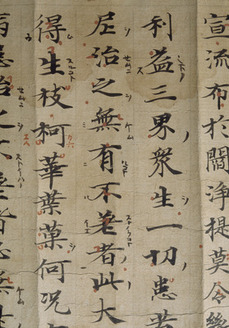
Konkōmyōsaishōō-kyō (Suvarṇaprabhāsottama-rāja-sūtra), Vol.1-10 (Kokubunji-kyō)
金光明最勝王経 巻第一~十(国分寺経)
Calligraphy & Books · Nara, 8th centuryNara NM
Home › Browse › Calligraphy & Books › Nara period › Map of the estate of Tōdaiji Temple in Takakushi village in Echizen Province
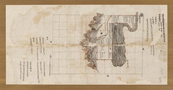
This map depicts the fields and surroundings of land developed as a territory of Tōdaiji Temple in Sakai District of Echizen Province, the northern part of present-day Fukui prefecture. The fields have place names and the acreage written in; these are near the center of the map, and they are bordered by lushly wooded hills on one side and a lake home to a swimming fish on the other. This Map is a draft. The northern direction is at the top of the map, and the borders of the estate are displayed by grid lines in ink. Water, mountains, and trees are painted in reddish purple and black ink. A big fish is symbolically depicted within the water. These maps are noteworthy landscape paintings of the Nara period.
A canal is depicted in reddish purple. The inscription by the administrator of the province of Echizen and the estate inspector from Tōdai-ji temple are at the left part of the map. This drawing of an estate owned by Tōdaiji Temple in Sakai District, Echizen Province (now northern Fukui Prefecture), is dated the 21st day of the 10th month of Tenpyō Jingo 2 (November 27, 766 [Julian calendar] ). Near the center of the drawing, the estate is shown between wooded mountains and a lake with fish swimming in it. The squares in that section have the place names and land area written in them.
— Museum description: Nara National Museum (CC BY 4.0), via ColBase / Japan Search.